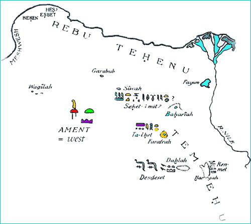
In ancient times Libya began west of the Nile and most of the inhabitants of the Egyptian Delta were native Berbers (Imazighen). This map is part of the map of Ancient Libya, showing the locations of the native Berber tribes of Ancient Egypt. Hence the ancient Greek geographers referred to the whole Africa by the name of "Libya". For more information please see the Temehu tribes of ancient Libya. 1914 Libya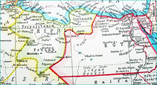
Map of Libya & North Africa in 1914, showing The Country Tripoli (in green). From: Harmsworth's Atlas of The World And Pictorial Gazetteer With An Atlas of The Great War, Edited by J. A. Hammerton, The Amalgamated Press, LTD., London, pp. 284-285. For more information about these maps see our Libya page. 1920 Libya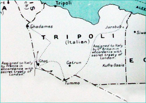
1920s Italian Tripoli, from:
"Imperial Military Geography", by D. H. Cole, London, 1928, p. 78.
1930 Libya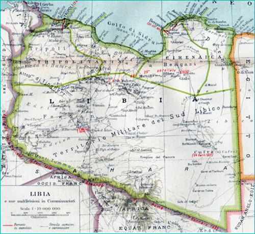
Libya under Italian occupation, 1934. Image based on the image from: Administrative subdivision of Italian Libya, from "Atlantino storico" (1938), by professor Arcangelo Ghisleri. Source:Wikipedia Tuareg Confederacies & Territories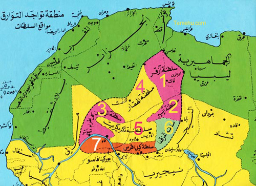
Coloured regions of the Sahara & North Africa, showing the locations of Tuareg confederacies & territories.For more information please see: tuareg-confederacies.htm Caravan Routes Map
Feuling Stations Map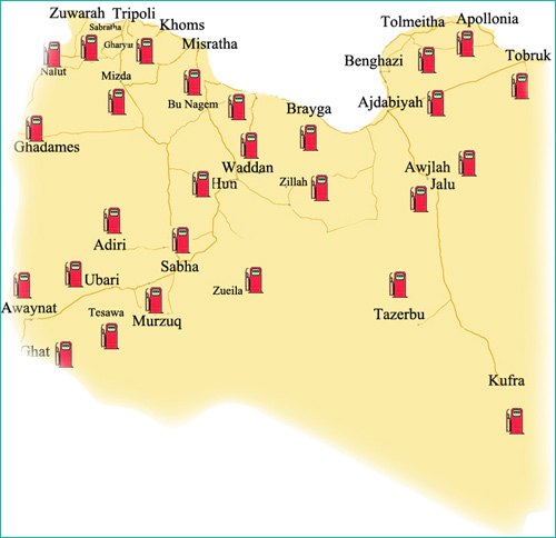
The Strange NFZ Over Libya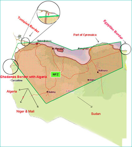
The above image is a modified map of the The published No-Fly-Zone over (some parts of) Libya. The modified map was completed by Temehu.com to illustrate the actual size of the NFZ in relation to the whole of Libya, and to show how all the land borders of Libya are left out of the map!? To see a copy of the published map, please see: https://upload.wikimedia.org/wikipedia/commons/6/66/Operation_Odyssey_Dawn_-_No_Fly_Zone_-_Libya_March_2011.jpg |